


Wetland and Riparian Data
USFWS NWI Data
Mapping Standards
- Cowardin Wetland Classification
- FGDC Wetland Standard
- USFWS Riparian Standard
Partners Map
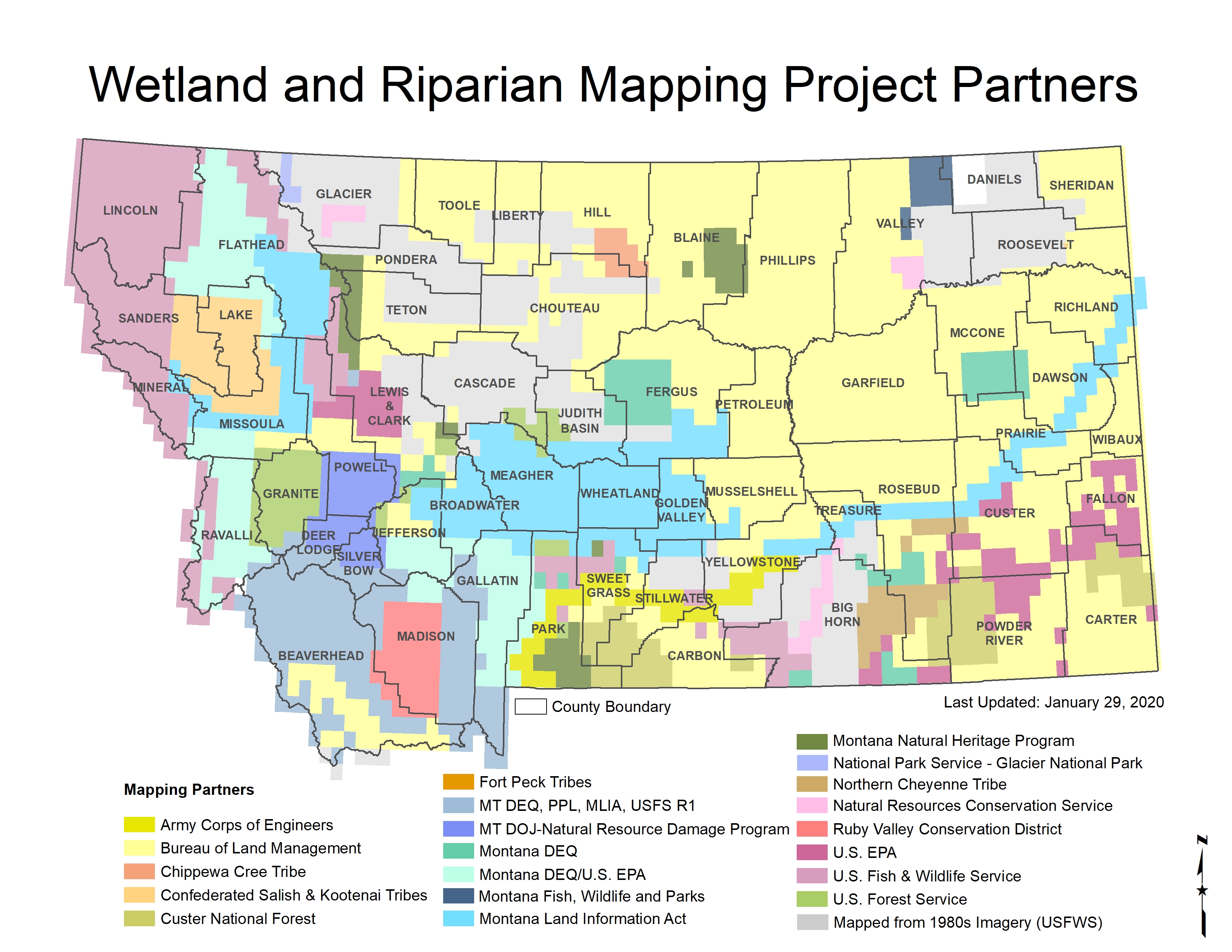
|
Status of Wetland and Riparian Mapping in Montana
Click on the map for a larger image of the current mapping status.
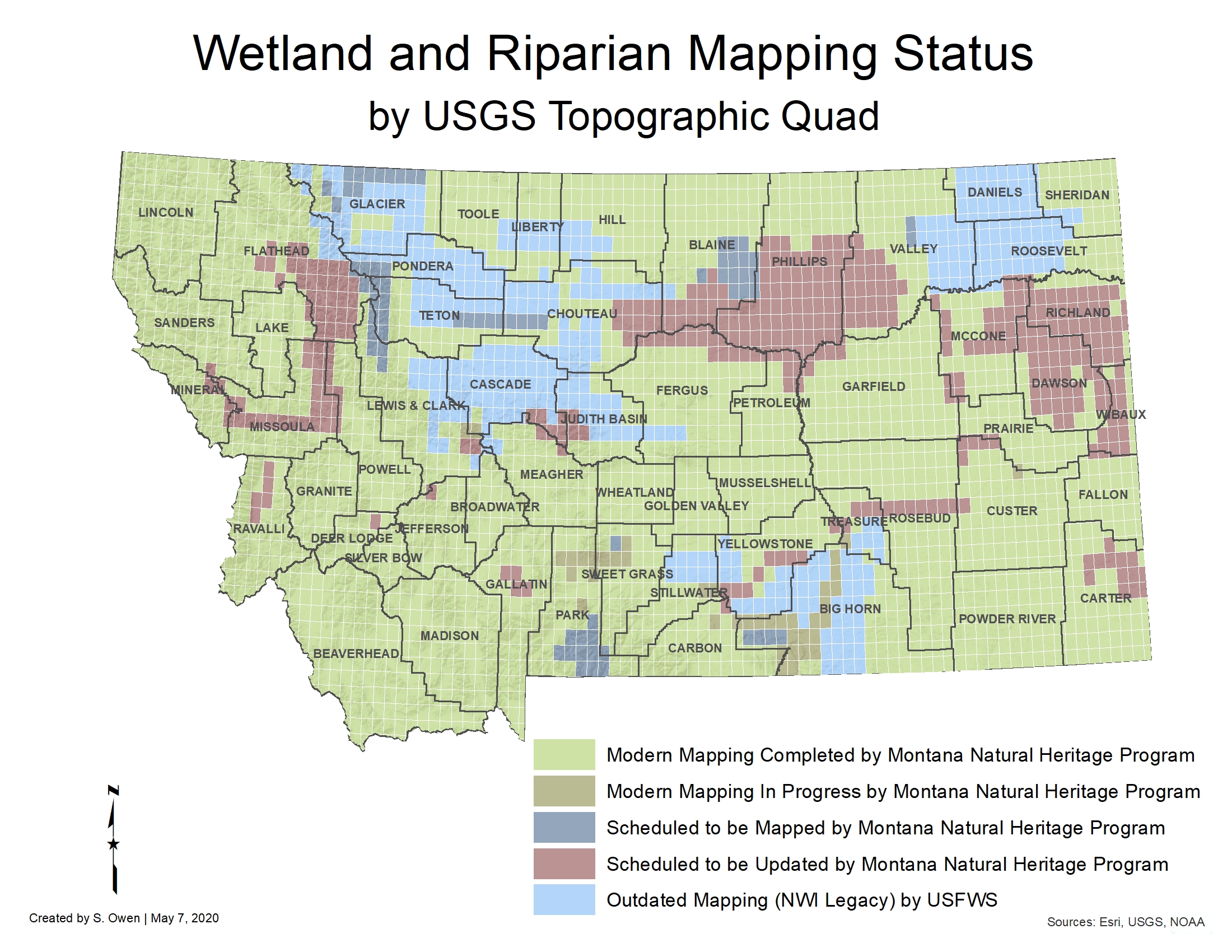
 Mapping Status Information
Wetland and Riparian Mapping Progress-June 2019 |
|
| 2,445 USGS 24K Quads Mapped - 3,200,274 Total Acres Mapped | |
| Wetland Acres Mapped: 2,530,053 | Riparian Acres Mapped: 670,221 |
| Mapping Progress Documentation | |
