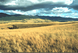
The War on Weeds...
Weed Districts use the Natural Heritage databases for information on sensitive species in weed control areas.

One weed management consultant reported that without the services of the Heritage Program: "it would take at least 4 to 5 additional days to gather information for each project"

Natural Heritage Program Overview
Montana's Natural Heritage is a diverse resource for our citizens and economy, and is central to our quality of life. Good information is critical to maintain this valuable heritage as the state grows and develops.
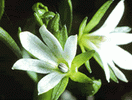
Preventing Species Listings...
Sometimes "rarity" is due to lack of information.
Data assembled by the Natural Heritage Program have led to the "down-ranking" of many species once thought to be very rare, or considered for listing as Endangered Species. Fourteen plants were dropped as candidates for Federal listing when data showed that the plants were more widespread than previously thought. Likewise, accurate data on listed species are essential to determine when they can be de-listed.
 |
 |
The Montana Natural Heritage Program is a program of the Montana State Library's Natural Resource Information System. For additional information, contact the MTNHP Program Coordinator at 406-444-3989 or email mtnhp.org@mt.gov.
Facilitating Environmental Assessment...
Environmental reviews are expedited by readily accessible data on sensitive species and habitats.
Heritage data are used by the private and public sectors for mining, timber sales, subdivisions, utility and pipeline corridors, oil and gas developments, and highway construction.
Conflicts and unnecessary impacts are avoided because good data help developers identify sensitive species and areas early in the planning process.