Map Name
Alzada
Angela
Ashton
Baker
Belt
Big Snowy Mountains
Big Timber
Bighorn Crags
Billings
Birney
Bonners Ferry
Borah Peak
Bozeman
Bridger
Broadus
Butte North
Butte South
Canyon Ferry Dam
Chester
Choteau
Circle
Coeur D'Alene
Conrad
Culbertson
Cut Bank
Dearborn River
Dillon
Dodson
Dubois
Ekalaka
Elliston
Ennis
Forsyth
Fort Benton
Fort Peck Lake East
Fort Peck Lake West
Gardiner
Glasgow
Glendive
Great Falls North
Great Falls South
Hamilton
Hardin
Harlem
Harlowton
Havre
Headquarters
Hebgen Lake
Hungry Horse Reservoir
Hysham
Jordan
Kalispell
Lame Deer
Leadore
Lewistown
Libby
Lima
Livingston
Lodge Grass
Lonesome Lake
Malta
Melstone
Miles City
Missoula East
Missoula West
Musselshell
Nez Perce Pass
Opheim
Philipsburg
Plains
Plentywood
Polson
Powderville
Red Lodge
Richey
Ringling
Rocky Boy
Roundup
Saint Mary
Salmon
Sand Springs
Sandpoint
Scobey
Seeley Lake
Sidney
Swan Peak
Sweet Grass Hills
Terry
Thompson Falls
Townsend
Valier
Wallace
White Sulphur Springs
Whitefish Range
Whitewater
Wibaux
Winifred
Winnett
Wisdom
Wolf Point
Yaak River
Zortman
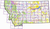
Montana Land Management Maps
Updated August 2011
These maps are produced by the Montana Natural Heritage Program from its Land Management database. The 102 maps are based on the US Geological Survey 1:100,000 scale topographic map series and use those boundaries as the indexing tiles.
The maps depict four main categories of land management:
- Public Lands
- Conservation Easements
- Special designated lands such as wildlife refuges, Research Natural Areas, wilderness, etc.
- Lands owned by land trusts or other private conservation oriented entities.
| The maps are intended to display an overall view of land management. |
|
The maps are not intended as a legal representation of public or private land boundaries. |
All maps are provided in Adobe PDF format. The maps are designed to be printed at a size of 36 by 30 inches on a large format printer.
Click on a map name in the list to the left to open a PDF file of the map.
Or, click on the map below to open a larger map to select from.