


Overview
Wetlands and riparian areas are one of the 15 themes in the Montana Spatial Data Infrastructure (MSDI), and our goal is to create a statewide digital wetland and riparian layer as a resource for management, planning, and restoration efforts.
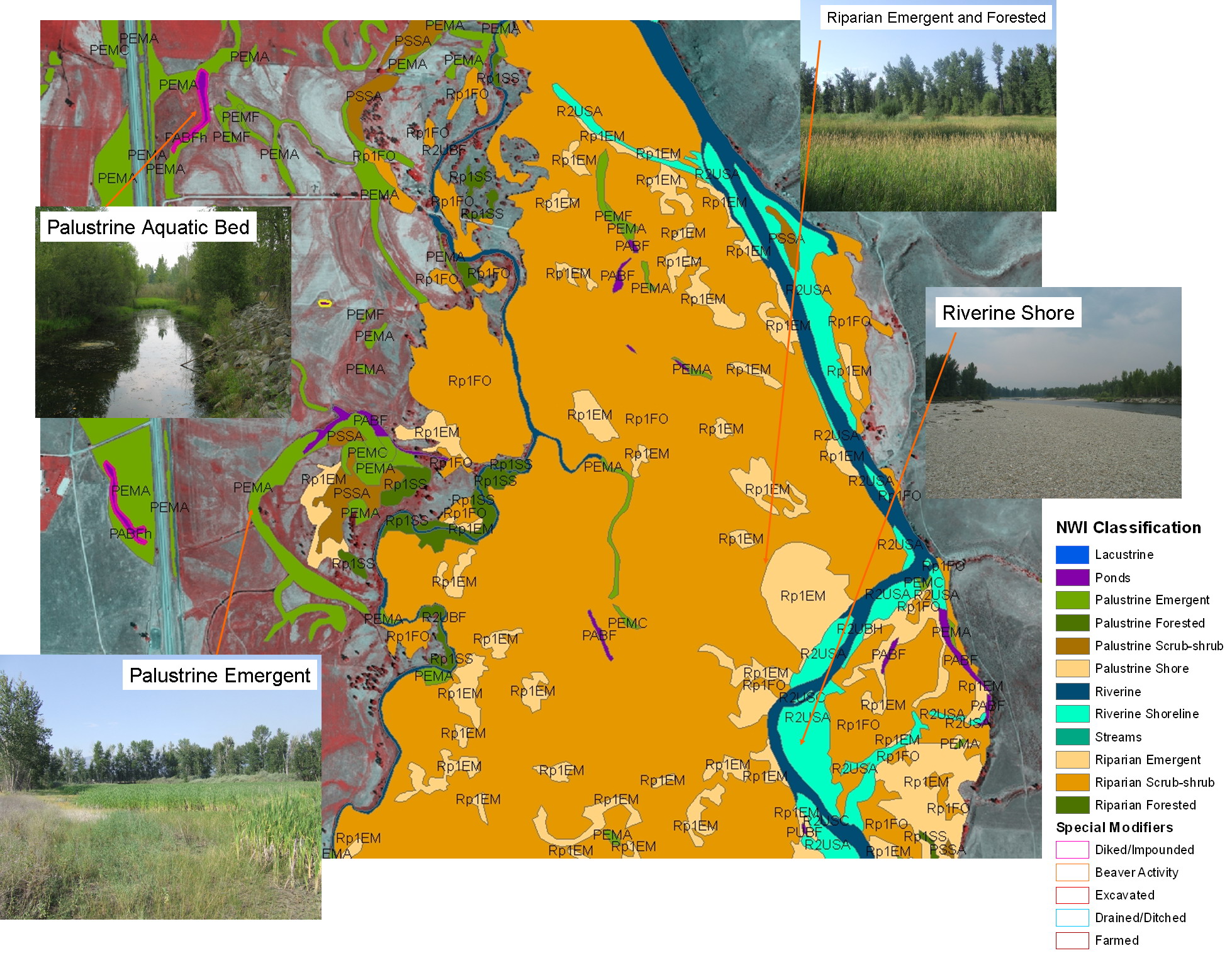
With support from our partners, we map wetlands and riparian areas to FGDC and USFWS National Wetlands Inventory (NWI) wetland and riparian standards.
Additionally, wetland mapping can be enhanced by incorporating descriptors to characterize hydrogeomorphic features to identify potential wetland function. These descriptors are added to each wetland polygon to describe the landscape position, landform, water flow path, and waterbody type (LLWW).
Digital wetland mapping is necessary to effectively and efficiently assess Montana's wetlands by identifying the type, size, and location of wetland resources.
Wetland and Riparian Mapping Center
Other Information
Mapping Status
|
Related Links
- Wetland & Riparian Mapping
- Montana Wetland Council
- US EPA Wetlands Info
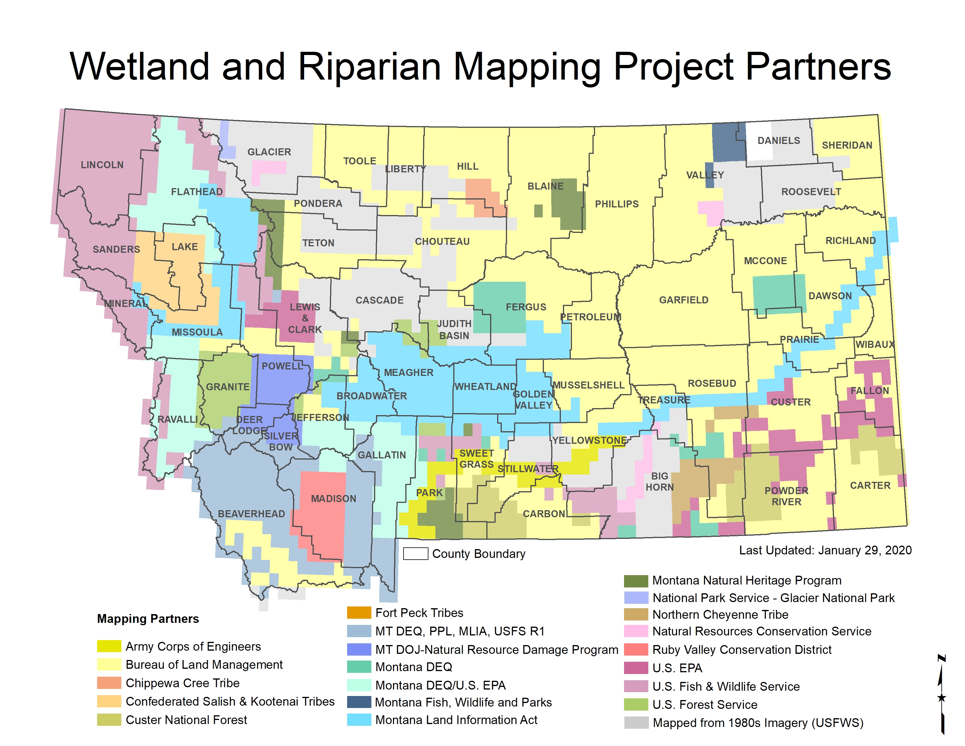
Partners Map
|
