On-line Mapping
Maps and Information
Land Management Mapping
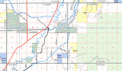 Montana's landscape is a complex,
constantly changing patchwork of federal, state, private and tribal ownership.
Within these ownerships are many kinds of designations, ranging from Wilderness to game ranges to conservation easements.
Because information on land management is critical to effective land management, the Montana Natural Heritage Program
began integrating ownership and management data into a land management mapping data system in 1997. The goal of the
Montana Land Management Mapping Project is to manage a single, statewide digital data set that incorporates information
from both public and private entities. It assembles public land ownership data from state and federal agencies, as well
as land trusts on a regular basis,with a major database update occurring every winter.
Montana's landscape is a complex,
constantly changing patchwork of federal, state, private and tribal ownership.
Within these ownerships are many kinds of designations, ranging from Wilderness to game ranges to conservation easements.
Because information on land management is critical to effective land management, the Montana Natural Heritage Program
began integrating ownership and management data into a land management mapping data system in 1997. The goal of the
Montana Land Management Mapping Project is to manage a single, statewide digital data set that incorporates information
from both public and private entities. It assembles public land ownership data from state and federal agencies, as well
as land trusts on a regular basis,with a major database update occurring every winter.
View news about the Montana Land Management Mapping Program.
Natural Heritage Resources