


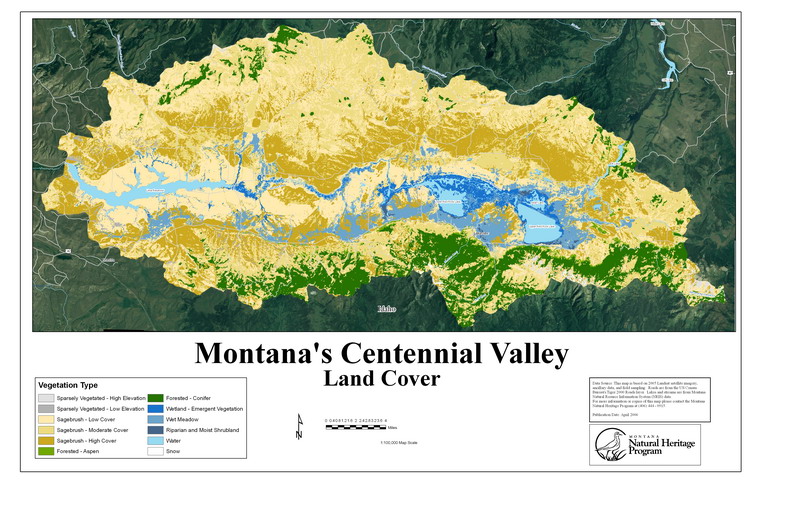
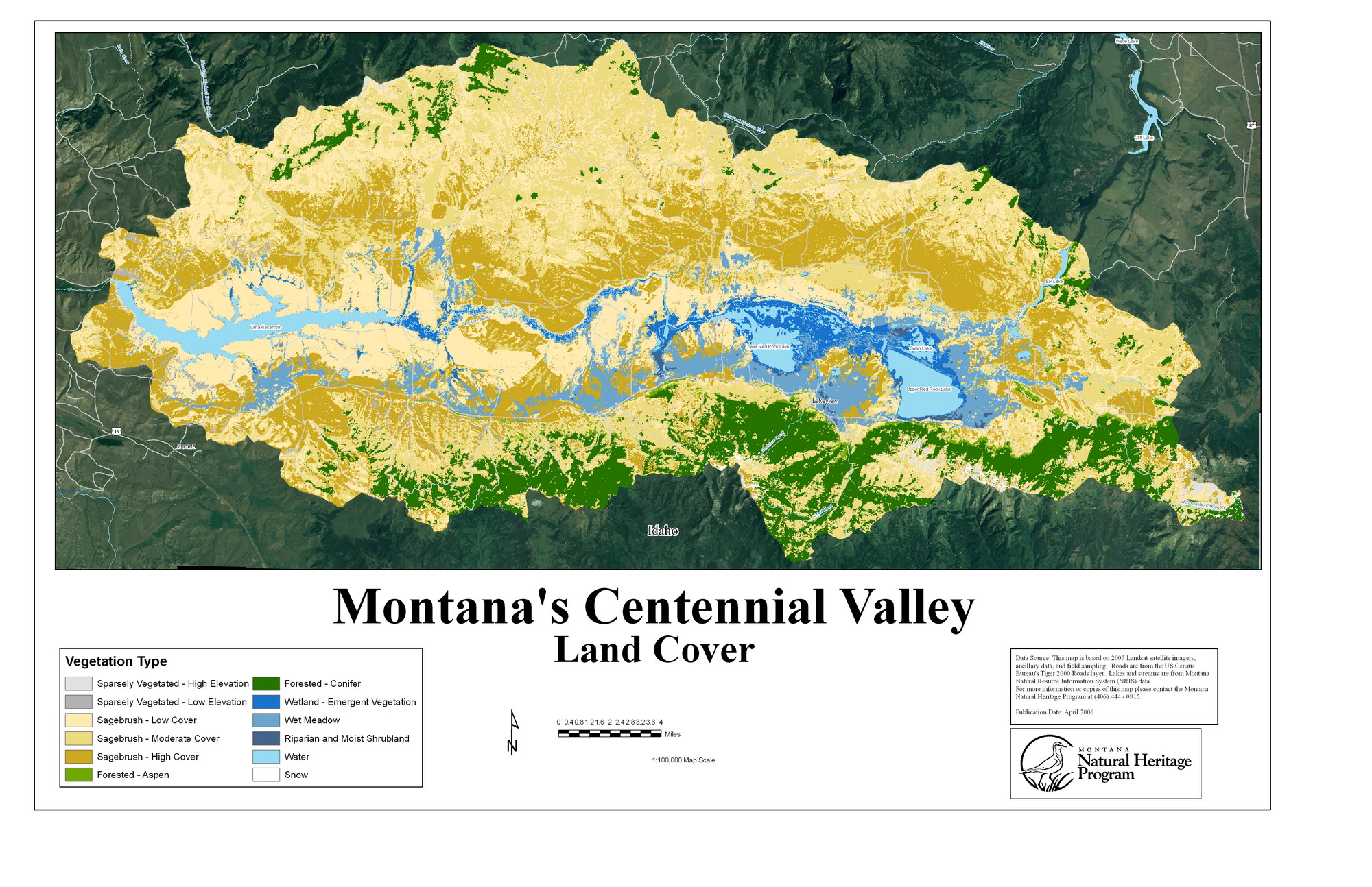
About the Map
Landsat Thematic Mapper satellite data was classified based on ground truth plots. We focused on lower elevation types since the map data was developed as a base layer for invasive species modeling in these areas. We also mapped three classes of sagebrush cover to aid the management of sagebrush dependent species. The low cover sagebrush class includes grasslands with no sagebrush, since these areas are not very common in Centennial Valley uplands.
Map Links
Centennial Valley Land Cover Information
The Centennial Valley is part of the Greater Yellowstone ecosystem and near Montana’s border with Idaho. The largest wetland complex in Montana, centered in the Red Rock Lakes National Wildlife Refuge, is on the valley floor. North of Red Rock Lake lies a unique sandhills community with rare plant species and vegetation communities. There have been 261 bird species recorded (70% of all the species found in Montana) with at least 150 species of birds breeding in the valley including the highest nest density of trumpeter swans in the West. See more detail about the Refuge and the Centennial Valley in this report.
Centennial Valley Land Cover Map
