


Community Field Guide
Scientific Name:
Pinus ponderosa / Pseudoroegneria spicata Woodland
Common Name:
Ponderosa pine / bluebunch wheatgrass Woodland
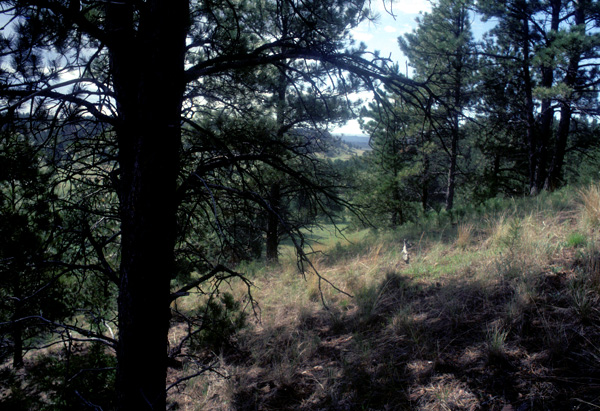
Photo by Bonnie Heidel
Community Description
Summary:
This ponderosa pine woodland exemplifies one of the driest woodlands found in the northern Rocky Mountains, Intermountain, and extreme northwestern Great Plains of the United States and adjacent portions of Canada. It is usually found on slopes with a high solar insolation load, exhibiting coarse soils, and frequently with a high gravel or rock content. Pinus ponderosa is typically the only tree in the overstory, although Juniperus scopulorum may be present in the sub-canopy. It forms open- to moderately closed-canopies. There are very few shrubs. The herbaceous layer is dominated by Pseudoroegneria spicata. Other species found in this layer are Carex filifolia, Carex inops ssp. heliophila, Koeleria macrantha, Achillea millefolium, Balsamorhiza sagittata and Hesperostipa comata (=Stipa comata).
Environment:
This community occurs predominantly on steep southerly aspects. It is found on coarse soils derived from sandstone, porcillenate, or limestone (Thilenius et al. 1995). These include sandy alluvium, gravelly or sandy till, and loams with high stone content. Rock and mineral soil are commonly exposed. These are very stressful sites that include escarpments, slope shoulders, and moderate- to steep- south- to southwest-facing slopes, and mesa edges where soil is shallow. It is found predominantly on sandstone or occasionally on fissile shale/siltstone that weathers to sand- or gravel-sized particles and mimics sandstone as it interacts with soil water. The amount of exposed ground (soil and gravel) varies widely (20% to 80%), perhaps more related to the degree of slope than community composition and the production of litter. It is not readily apparent what site parameters separate this community developing on slopes from immediately adjacent communities, either Pseudoroegneria spicata dominated or Artemisia tridentata ssp. wyomingensis shrub-steppe vegetation that gives no indication of ever supporting Pinus ponderosa. Though data is fragmentary it appears that compositional nuances respond to parent material differences (or a related factor).
Vegetation: The tree canopy structure, at least in the Alkali Creek study area, is that of a very open woodland, that verges on savanna though technically is not, due to a tree cover greater than that of any other lifeform. Pinus ponderosa ranges in cover from about 10% to approaching 30%. Juniperus scopulorum was not noted growing on sandstone or sandstone colluvium but it is present as depauperate specimens in barely greater than trace amounts on fissile shales. The shrub component apparently varies according to parent material with Rhus aromatica and Yucca glauca found as a minor component on sandstone and Sarcobatus vermiculatus and Atriplex confertifolia found on fine textured sedimentaries. Pseudoroegneria spicata is the dominant graminoid though its cover is rivaled by, and occasionally exceeded by that of Hesperostipa comata; their combined cover seldom exceeds 20%. Other high constancy graminoids include Achnatherum hymenoides (=Oryzopsis hymenoides) and Carex filifolia. We also noted that a transition from sandstone to shale (or siltstone) substrates is accompanied by the appearance of, or greater proportion of, Elymus lanceolatus. The cover of Bromus japonicus, despite the open canopy and exposed ground, is present in only trace amounts. Psoralea tenuiflora, Pediomelum argophyllum (=Psoralea argophylla) and Sphaeralcea coccinea are the only forbs, except the exotic Melilotus officinalis, with greater than 50% constancy and also the only ones to occur in greater than trace amounts.
The tree and herbaceous strata dominate this community. Pinus ponderosa is often the only tree in the overstory. The tree coverage can vary from open to moderately closed. In northeastern Wyoming, most of the trees were less than 15 m tall with diameters at breast height less than 60 cm (Thilenius et al. 1995). On three stands in the eastern portion of this type�s range, Hansen and Hoffman (1988) found that total cover of the understory strata was 55%. Shrubs made up only 1.3% of this total. The herbaceous stratum is open to moderately dense. Pseudoroegneria spicata is the dominant and diagnostic herb when its cover exceeds that of other undergrowth species and there is a lack of other indicators of more mesic conditions. Other species that are often found in the central and eastern portions of its range are Achillea millefolium var. occidentalis, Carex filifolia, Carex inops ssp. heliophila, Koeleria macrantha, and Hesperostipa comata. In the western portion of the range of this community, Festuca idahoensis may be present (Daubenmire 1952), but canopy cover in excess of 5% would be indicative of the more mesic Pinus ponderosa / Festuca idahoensis plant association. When shrubs are present they typically include Ericameria nauseosa (=Chrysothamnus nauseosus), and especially on sandy soils, Rhus aromatica.
Range:
This ponderosa pine woodland is one of the drier ponderosa pine woodlands found in the northern Rocky Mountains, Intermountains, and extreme northwestern Great Plains of the United States and Canada, extending from the Black Hills of South Dakota and Wyoming west to Oregon, Washington, and British Columbia.
Dynamics:
Despite the widely spaced trees and relative paucity, or at least patchy distribution of fuels, this type experienced predominantly stand-replacing fire in the course of the Alkali Creek burn. A more typical and expected response when these conditions occur in Fire Group Two (warm, dry Pinus ponderosa habitat types; Fisher and Clayton 1983) is an underburn or surface fire. The Pinus ponderosa of this community type in the Bull Mountains and in the Alkali Creek study area generally bore no fire scars. This observation probably reflects the light fuels condition for this type and may also point to the exceptional Alkali Creek Fire conditions. The lack of Juniperus scopulorum in this type may be attributable to past fires killing this species and leaving the Pinus ponderosa overstory intact; this scenario has been documented by Culwell et al. (1991) in the Bull Mountains of central Montana.
Global Rank: G4 State Rank: S4
Community References
Identifier:
CEGL000865
Author:
Drake, J. F., WCS, mod. Cooper, S. V. and C. Jean, MTNHP
Citations:
Clausnitzer and Zamora 1987, Cooper et al. 1987, Culwell et al. 1985, Daubenmire 1952, Daubenmire 1970, Daubenmire and Daubenmire 1968, DeVelice et al. 1995, Hall 1973, Hansen and Hoffman 1988, Hoffman and Alexander 1976, Johnson and Clausnitzer 1992, Johnson and Simon 1987, Jorgensen 1979, McLean 1970, Pfister et al. 1977, Steele et al. 1981, Thilenius et al. 1995)
View Detailed Citation Information | New Community Search | NatureServe Explorer Community Information
This information is from the:
Montana Natural Heritage Program
Montana State Library--Natural Resource Information System
1515 East Sixth Ave., Helena, MT 59620-1800
406 444-3989
mtnhp.org
mtnhp@mt.gov
