


Community Field Guide
Scientific Name:
Pinus flexilis / Juniperus communis Woodland
Common Name:
Limber pine / common juniper Woodland
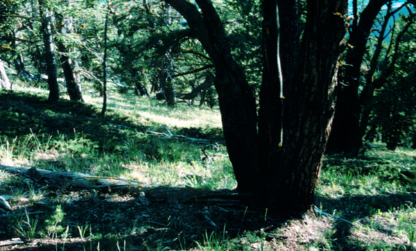
Photo by S.V. Cooper
Community Description
Summary: The herbaceous component is generally depauperate in number and cover especially on granitic substrates. The most constant forbs are Galium boreale.
Though a widespread association Pinus flexilis / Juniperus communis is limited in areal extent occurring as a small- to large-patch type east of the Continental Divide from Alberta south to Colorado. It is generally found at the lowest elevations of the forested zone to mid-elevations; in Montana this translates to a 3,900 feet elevation span starting at 4,300 feet along the Rocky Mountain Front. It generally is found on thin soil and calcareous substrates, though all varieties of parent material are represented. This is one association where indicator status of a less shade tolerant tree species, Pinus flexilis, has been accorded greater weight than a more shade tolerant species, Pseudotsuga menziesii, in the recognition and naming of this association (see Pfister et al. 1977, Steele et al. 1981). However, this is true only when Pinus flexilis is associated with thin soil and exposed and generally droughty sites where it can establish itself as a seral species, and maintain dominance in long-term stable stands. The only seral tree species capable of occurring in this association, Pinus contorta and Populus tremuloides, are restricted to particular substrate types. Well-represented Juniperus communis is the diagnostic undergrowth species and almost invariably dominates as well. Other important shrubs are Juniperus horizontalis, Arctostaphylos uva-ursi, and Shepherdia canadensis.
Environment:
This minor type generally appears at low- to mid-elevations of the forested zone, which in northern Montana extends from approximately 4,300 feet to 6,200 feet but on south facing or wind impacted slopes in this vicinity may go as high as 7,000 feet. In more southerly (central Idaho) areas it may be found as high as 9,500 feet. It often occurs on south- to west-facing slopes with thin soils and a degree of exposure to prevailing winds. Though it occurs on a variety of parent materials, it is much more extensive on calcareous substrates (usually limestone) which tend to be shallow and gravelly with considerable exposed surface rock (reaching 20% on the most exposed slopes). The relatively greater soil depths, less exposed soil and rock, and deeper duff accumulations that are exhibited by other associations in this series are indicative of its higher moisture status. Adjacent drier sites are either non-forest environments, other Pinus flexilis plant associations, or in some regions of Montana, occupied by Cercocarpus ledifolius / Pseudoroegneria spicata, and moister sites may be occupied by any of a number of Pseudotsuga menziesii series associations.This minor type generally appears at low- to mid-elevations of the forested zone, which in northern Montana extends from approximately 4,300 feet to 6,200 feet but on south facing or wind impacted slopes in this vicinity may go as high as 7,000 feet. In more southerly (central Idaho) areas it may be found as high as 9,500 feet. It often occurs on south- to west-facing slopes with thin soils and a degree of exposure to prevailing winds. Though it occurs on a variety of parent materials, it is much more extensive on calcareous substrates (usually limestone) which tend to be shallow and gravelly with considerable exposed surface rock (reaching 20% on the most exposed slopes). The relatively greater soil depths, less exposed soil and rock, and deeper duff accumulations that are exhibited by other associations in this series are indicative of its higher moisture status. Adjacent drier sites are either non-forest environments, other Pinus flexilis plant associations, or in some regions of Montana, occupied by Cercocarpus ledifolius / Pseudoroegneria spicata, and moister sites may be occupied by any of a number of Pseudotsuga menziesii series associations.
Vegetation:
Pinus flexilis dominates the canopy, often sharing this status with Pseudotsuga menziesii; a sub-canopy of Juniperus scopulorum is often noted, though usually the cover is less than 10%. On granitic substrates Pinus contorta is capable of occurring as an important seral component, though even in these open stands it shows no indication of successful reproduction; the presence of Pinus contorta here is indicative that this is the most mesic association in the Pinus flexilis series. The undergrowth is dominated by the diagnostic species Juniperus communis; other shrubs capable of attaining a considerable presence include Juniperus horizontalis, Arctostaphylos uva-ursi and Shepherdia canadensis. The herbaceous component is generally depauperate in number and cover especially on granitic substrates. The most constant forbs are Galium boreale, Anemone nuttalliana, Anemone multifida, Clematis columbiana, Arnica cordifolia, Campanula rotundifolia and Astragalus miser is both highly constant and often the dominant forb. Bunchgrasses (Pseudoroegneria spicata, Festuca idahoensis, and Festuca kingii) are consistently present with low coverage values.
Range:
This is a broadly distributed small- to large-patch association largely coincident with the distribution of Pinus flexilis, occurring east of the Continental Divide along the Rocky Mountain Front in Alberta and extending south and eastward to the Middle Rocky Mountains of southeastern Wyoming (Alexander et al. 1986) and northwestern Colorado (Hoffman and Alexander 1980, Johnson 1987). Pinus flexilis / Juniperus communis is found as far west as the Blue Mountains of Oregon (Cole 1982) and Lost River and Lemhi Ranges of Idaho (Steele et al. 1981) where it is an incidental type. It may also occur in Nevada�s portion of the Great Basin and is strongly alluded to in central and southern Utah (Youngblood and Mauk 1985) but data are insufficient to confirm its presence.
Dynamics:
Following disturbance, usually inferred to as mixed-severity fire, both Pinus flexilis and Pseudotsuga menziesii reestablish at a very slow rate with the created canopy gaps lasting for tens to scores of years. However, old-growth stands show little evidence of fire suggesting low wildfire frequency in this association. It has been shown that much of Pinus flexilis establishment in this and other habitats potentially dominated by Pinus flexilis is due to the germination of unharvested seed caches of the Clark�s nutcracker. The white pine blister rust that infests all five-needle pines has begun to cause massive mortality in Pinus flexilis along Montana�s Rocky Mountain Front. Given the climatic similarity of this area to the rest of this association�s distribution, and that the spores are wind-dispersed, this type should be considered under threat across its distribution.
Global Rank: G5 State Rank: S4
Community References
Identifier:
CEGL000807
Author:
01-03-12 / S. V. Cooper, MTNHP
Citations:
Alexander et al. 1986, Cole 1982, Hess 1981, Hess and Alexander 1986, Hoffman and Alexander 1980, Johnston 1987, Johnston and Hendzel 1985, Pfister et al. 1977, Steele et al. 1981, Steele et al. 1983, Wasser and Hess 1982, Youngblood and Mauk 1985
View Detailed Citation Information | New Community Search | NatureServe Explorer Community Information
This information is from the:
Montana Natural Heritage Program
Montana State Library--Natural Resource Information System
1515 East Sixth Ave., Helena, MT 59620-1800
406 444-3989
mtnhp.org
mtnhp@mt.gov
