Metadata Download  View Map Services More Info
Species Information
Observations Animal 
Plant 
Request Snapshot
MapViewer
Field Guide
-
SOC Species Occurrences Animal 
Plant 
Request Snapshot
MapViewer
- -
Animal Structured Surveys Request MapViewer - -
Range Maps -- Animals - Request MapViewer
Field Guide
- -
Predicted Suitable Habitat - Predicted Models - -
Ecological Information
Land Cover MapViewer -
Wetlands and Riparian Mapping MapViewer
Land Management Information
Public Lands MapViewer -
Conservation Easements MapViewer -
Managed Areas MapViewer -
Montana Geographic Information
Montana Geographic Information -

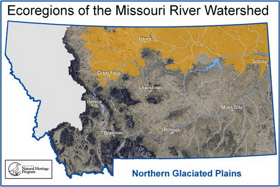
Northern Glaciated Plains Ecoregion Key

Stream 1st-2nd order or <30 miles long Northern Glaciated Intermittent Stream
Stream 3rd-5th order or 30 - 100 miles long Northern Glaciated Prairie Stream
River >5th order or >100 miles long Medium Prairie River
River >5th order and >200 miles long and a direct tributary to the Missouri River (Milk or Marias Rivers) Large Prairie River
The Missouri River downstream from Great Falls Large Valley River

Ecoregions are based on Omernik’s Level III Ecoregion delineations (see Woods, A.J. et al. 2002. Ecoregions of Montana. 2nd edition poster). The Northwestern Great Plains are the Northwestern Great Plains Level III Ecoregion (#43).