


Community Field Guide
Scientific Name:
Pseudoroegneria spicata - Bouteloua gracilis Herbaceous Vegetation
Common Name:
Bluebunch wheatgrass - blue grama Mixedgrass Prairie
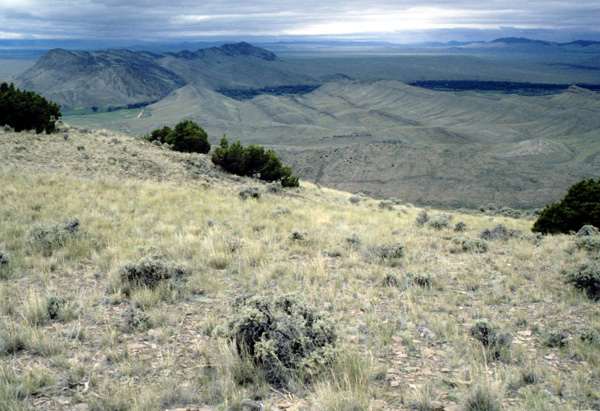
Photo by Andrew Kratz
Community Description
Summary:
This bluebunch wheatgrass grassland type is found in the western Plains and at low elevations in the Front Range of the Rocky Mountains. In Montana stands are found on toeslopes of the foothills and steeper slopes of valley bottoms. Soils are typically moderately deep (40-100 cm), with a variety of parent materials, and neutral in pH. Surface rock varies from 1-46%. In Montana, the vegetation is open (40-60% cover) and dominated by graminoids. Pseudoroegneria spicata shares dominance with Hesperostipa comata (= Stipa comata). Bouteloua gracilis is always present, but in varying amounts depending on grazing history (increasing with heavy grazing). Associated graminoids include Carex duriuscula (= Carex stenophylla), Koeleria macrantha, and Poa secunda (= Poa sandbergii). The most constant forbs include Artemisia frigida (sometimes classified as a shrub), Phlox hoodii and Sphaeralcea coccinea. Slightly more productive sites contain Calamagrostis montanensis, Carex filifolia, Heterotheca villosa (= Chrysopsis villosa), and Liatris punctata. Shrub cover is less than 10%. Low-growing shrubs include Gutierrezia sarothrae and Opuntia polyacantha, and taller shrubs may include Ericameria nauseosa (= Chrysothamnus nauseosus).
Environment:
In Montana stands are found on toeslopes of the foothills and steeper slopes of valley bottoms. Soils are typically moderately deep (40-100 cm), with a variety of parent materials, and neutral in pH. Surface rock varies from 1-46% (Mueggler and Stewart 1980). Based on studies in southeastern Wyoming, Bouteloua gracilis, a C4 grass, becomes a minor component of the grassland vegetation above 2300 m, whereas Hesperostipa comata (= Stipa comata), a C3 grass, is present at over 2600 m (Boutton et al. 1980).
Vegetation:
In Montana, the vegetation is open (40-60% cover) and dominated by graminoids. Pseudoroegneria spicata shares dominance with Hesperostipa comata (= Stipa comata). Bouteloua gracilis is always present, but in varying amounts depending on grazing history (increasing with heavy grazing). Associated graminoids include Carex duriuscula (= Carex stenophylla), Koeleria macrantha, and Poa secunda (= Poa sandbergii). The most constant forbs include Artemisia frigida (sometimes classified as a shrub), Phlox hoodii and Sphaeralcea coccinea. Slightly more productive sites contain Calamagrostis montanensis, Carex filifolia, Heterotheca villosa (= Chrysopsis villosa), and Liatris punctata. Shrub cover is less than 10%. Low-growing shrubs include Gutierrezia sarothrae and Opuntia polyacantha, and taller shrubs may include Ericameria nauseosa (= Chrysothamnus nauseosus) (Mueggler and Stewart 1980).
Range:
This community is reported from 3 ecoregional sections in Colorado, Montana, and possibly Wyoming.
Dynamics:
Fire and grazing are the most probable natural disturbances. Grazing by pronghorn antelope occurs during the growing season, and both mule deer and elk may utilize this type for winter range (Mueggler and Stewart 1980).
Global Rank: G4 State Rank: S3
Global Rank Comments:
No occurrences have been documented, but this community is reported from 3 ecoregional sections in Colorado, Montana, and possibly Wyoming. In Montana stands are found on toeslopes of the foothills and steeper slopes of valley bottoms with moderately deep, neutral soils derived from a variety of parent materials.
Community References
Identifier:
CEGL001664
Author:
S.V. Cooper
Citations:
Bear Creek Uranium Mine Application n.d., Bourgeron and Engelking 1994, Boutton et al. 1980, Driscoll et al. 1984, Francis 1983, Mueggler and Stewart 1980, Terwilliger and Tiedemann 1978, Thilenius et al. 1995, Tiedemann et al. 1987
View Detailed Citation Information | New Community Search | NatureServe Explorer Community Information
This information is from the:
Montana Natural Heritage Program
Montana State Library--Natural Resource Information System
1515 East Sixth Ave., Helena, MT 59620-1800
406 444-3989
mtnhp.org
mtnhp@mt.gov
