


Community Field Guide
Scientific Name:
Symphoricarpos occidentalis Shrubland
Common Name:
Western snowberry Shrubland
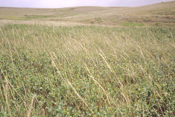
Photo by S.V. Cooper
Community Description
Summary: Throughout the community�s range, shrubs approximately 1 m tall dominate. Shrub cover is typically greater than 50%, and in places it approaches 100%. These shrubs form dense clumps that exclude most other species. Symphoricarpos occidentalis is the most common shrub, but Rhus aromatica (or Rhus trilobata) and Prunus virginiana can be locally abundant and can grow to 2 to 3 m in places. Toxicodendron rydbergii may also be present. Herbaceous species and smaller shrubs are most abundant at the edges of this community and in gaps between the clumps of taller shrubs where the shading is less complete. Rosa woodsii is a typical smaller shrub. Common graminoids include Pascopyrum smithii and Poa pratensis. Achillea millefolium, Artemisia ludoviciana, Galium boreale, and Solidago spp. are common forbs of this community. Woody vines sometimes occur, including Parthenocissus vitacea.
The western snowberry shrubland is found as a small- to large-patch type in mesic depressions, swales, ravines and floodplains, typically surrounded by upland grassland associations and occasionally forming a mosaic with Artemisia cana dominated polygons. The soils are silts, loams and sandy loams. Some stands are occasionally flooded whereas others are just very moist. Thus it tends to fall on both sides of the upland/wetland division. It has been classified in both temporarily and seasonally flooded wetland classes elsewhere in northeastern Montana, where it is among the most extensive of flooded wetland plant associations (Thompson 1994).
Environment:
This community is found in mesic swales, depressions, ravines and floodplains. Some examples of this community experience intermittent and brief flooding. The soils are fertile and well-drained to imperfectly drained silts and loams. The upper soil horizon is usually deep, although a thin layer of sand may be present if the site has been recently flooded (Jones 1995).
Vegetation: This association is present throughout the study area, including shallow prairie potholes, valley margins, and widely scattered elsewhere. This type is often invaded and not infrequently dominated by Poa pratensis (Kentucky bluegrass); less often, at least within the study area, Bromus inermis (smooth brome) expands to dominate within the swale environments (attaining greater cover than Symphoricarpos occidentalis) and then is capable of expanding to upslope, drier habitats as well.
This type has a shrub layer (app. 80 cm tall) with high canopy cover (averages > 50%), sometimes with well-developed graminoid- and forb-layers. Symphoricarpos occidentalis is the predominant species in the shrub layer and at times forms almost monospecific stands. Rosa woodsii (Wood�s rose) and sometimes Artemisia cana (silver sage) occur interspersed with the Symphoricarpos occidentalis. Stands that have not been excessively grazed may have a strong component of Pascopyrum smithii (western wheatgrass), Elymus lanceolatus (thickspike wheatgrass), Nassella viridula (green needlegrass) and Carex duriuscula (needle-leaved sedge); with increasing grazing pressure the Poa secunda (Sandberg�s bluegrass) complex, Poa pratensis (Kentucky bluegrass) and annual grasses (especially Bromus japonicus (Japanese brome)) become more prevalent. The most commonly occurring forbs can be categorized as increasers with disturbance including Achillea millifolium (common yarrow), Melilotus officinalis (yellow sweetclover), Artemisia ludoviciana (prairie sagewort), Glycyrrhiza lepidota (American licorice).
Range:
The western snowberry shrubland is found in the western tallgrass and northern Great Plains of the United States and Canada.
Dynamics:
Stands may occasionally flood (Jones 1995). Symphoricarpos occidentalis seems to thrive in disturbed areas (Hansen and Hoffman 1988), especially those subject to disturbance by fire and cattle grazing. Due to abundant root crown and rhizome sprouting Symphoricarpos occidentalis stem density appears greater on burned than unburned areas in the Alkali Creek Fire site. Nassella viridula (green needlegrass) appears to have decreased in burned areas.
Global Rank: G4G5 State Rank: S4S5
Global Rank Comments:
This type is common throughout the northern Great Plains. Historically, it may never have been very extensive. It has been observed to grow out from forest or woodland edges and shade out the grasses. It is tolerant of both grazing and fire (Hansen and Hoffman 1988), and is under no threat from human activities. In some cases, heavily grazed pastures may favor this types. Many examples are somewhat weedy; thus the type is not demonstrably secure.
Community References
Identifier:
CEGL001131
Author:
Drake, J. F., WCS
Citations:
Christy 1973, Clark 1977b, Clark et al. 1980, Hansen et al. 1984, Hansen et al. 1991, Hansen et al. 1995, Johnston 1987, Jones 1992, Jones and Walford 1995, Kittel et al. 1994, Kittel et al. 1999, McAdams et al. 1998, Meyer 1985, Steinauer and Rolfsmeier 1997
View Detailed Citation Information | New Community Search | NatureServe Explorer Community Information
This information is from the:
Montana Natural Heritage Program
Montana State Library--Natural Resource Information System
1515 East Sixth Ave., Helena, MT 59620-1800
406 444-3989
mtnhp.org
mtnhp@mt.gov
