


Community Field Guide
Scientific Name:
Juniperus scopulorum / Piptatherum micranthum Woodland
Common Name:
Rocky Mountain juniper / little-seed ricegrass Woodland
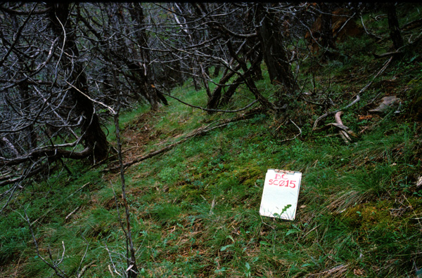
Photo by S.V. Cooper
Community Description
Summary: In Montana, only Juniperus scopulorum is present and dominant. This plant association is best-developed on sheltered aspects in dissected sedimentary plains. In Powder River County, this plant association is widely-scattered on escarpments, and dissected terrain along the south end of the Powder River.
This rocky mountain juniper community type is found in the western Great Plains of the United States. Stands occur almost exclusively on steep (30%-70%) north-facing slopes. The soils are shallow and poorly developed; loamy sands and sandy loams predominate. The vegetation structure and composition is an evergreen woodland with moderately open to dense cover of Juniperus scopulorum or less commonly Juniperus virginiana (red cedar), or introgressed hybrids of the two. Woody species other than Juniperus scopulorum or Juniperus virginiana occur sporadically, but none achieves prominence. Most of the trees are small (10-20 cm dbh) and few exceed 6 m. in height. Where the density of the tree canopy is high, the short-shrub and herbaceous strata are not well developed. In more open places Piptatherum micranthum is often abundant. Other common herbaceous species include Campanula rotundifolia (harebell), Galium boreale (northern bedstraw), and Maianthemum stellatum (starry Solomon�s seal). Mosses and lichens can cover much of the ground.
Environment: In Montana, this plant association occurs in a variety of Silty Ecological Sites that are well-drained owing to the slope and the gully-erosion in these settings. This community is best-developed on north aspects. In Powder River County, this type was found on thin silty ecological conditions. This is consistent with other Montana state data, with exception of thin clay conditions noted in Carter County (Vanderhorst et al. 1998).
This community typically occurs on moderate to steep (16%-70%), north-facing slopes, but can occur on a variety of aspects (Johnston 1987, Von Loh et al. 1999). The soils are poorly developed, shallow, loamy sands, sandy loams, and clay loams, sometimes with high gravel content. These woodlands are frequently associated with outcrops of sandstone (DeVelice et al. 1995) or scoria and clay slopes (Girard et al. 1989).
Vegetation: In Montana, this plant association is distinguished by the palatable bunchgrass Piptatherum micranthum having the highest graminoid cover at generally 10-30%, the absence or paucity of bluebunch wheatgrass (Pseudoroegneria spicata), high nonvascular cover, and often rich forb diversity and cover (DeVelice et al. 1995, Culwell et al. 1986, Vanderhorst et al. 1998). Hybrids between Juniperus scopulorum and Juniperus horizontalis have been reported and may account for the unusual growth form of stands along the Missouri Breaks where trees do not have a central axis (Roberts and Sibberman 1979, Heidel 1997).
This woodland community is dominated by small Juniperus scopulorum trees throughout most of its range, and is replaced by Juniperus virginiana and introgressant hybrids in the eastern portion of its range in Nebraska and South Dakota (Kaul et al. 1983, Von Loh et al. 1999). Acer negundo and Fraxinus pennsylvanica saplings are sometimes found in depressions where soil and moisture accumulate. Most of the juniper trees are 10-20 cm dbh and 4-6 meters tall, but some trees can be up to 30-40 cm dbh. The basal area has been reported at 22-29 m2/ Ha in North Dakota and up to 22-41 m2/ Ha in southeastern Montana and northwestern South Dakota (Nelson 1961, Hansen et al. 1984, Hansen and Hoffman 1988). Tree canopy is moderate to dense, e.g., in North Dakota, Girard et al. (1989) measured densities of 975 trees/ Ha. Where the canopy is dense the shrub and herbaceous strata are poorly developed. Where the canopy is less full, shrubs and herbaceous species are more abundant, e.g. on 7 stands in southwest North Dakota mosses and lichens covered 72% of the ground surface, shrubs covered 17.4%; graminoids 69.1%, and forbs 9.4% (Hansen et al. 1984). Among the shrubs that may be found in this community are Juniperus communis (common juniper), Juniperus horizontalis (creeping juniper), small Juniperus scopulorum (Rocky Mountain juniper) or Juniperus virginiana (red cedar), Mahonia repens (Oregon grape), Dasiphora fruticosa ssp. floribunda (shrubby cinquefoil), Prunus virginiana (common chokecherry), Rhus trilobata (skunkbush sumac), Ribes aureum (golden current), Ribes cereum (squaw current), Rosa woodsii (Wood�s rose), Symphoricarpos albus (common snowberry), and Symphoricarpos occidentalis (western snowberry). Typical herbaceous species include Anemone patens (pasqueflower), Antennaria microphylla (rosy pussytoes), Campanula rotundifolia (harebell), Carex inops ssp. heliophila (sun sedge), Chenopodium fremontii (Fremont�s goosefoot), Elymus lanceolatus (thickspike wheatgrass), Elymus trachycaulus (bearded wheatgrass), Galium boreale (northern bedstraw), Geum triflorum (prairie smoke), Koeleria macrantha (prairie junegrass), Piptatherum micranthum (littleseed ricegrass), Maianthemum stellatum (starry Solomon�s seal), Parietaria pensylvanica (Pennsylvania pellitory), and Taraxacum officinale (common dandylion) (Hansen et al. 1984, Hansen and Hoffman 1988).
Range: In Montana, this plant association is best represented on the open eastern sedimentary plains associated with river breaks and scattered escarpments. It is sometimes present at the margins of pine woodland landscapes but is not consistently part of them. In Powder River County, this plant association is present on northeastern escarpments, and valley segments of the Powder River in the southwestern corner of the County.
This rocky mountain juniper community type is found in the western Great Plains of the United States. It is found in the Black Hills and the Badlands of North and South Dakota and in Montana as far west as Phillips County, and from the High Plains of eastern Wyoming eastward to central Nebraska.
Dynamics:
This plant association is in relatively moist habitat that is not as prone to burning as surrounding vegetation types, but is highly flammable when dry. Juniperus scopulorum is readily killed by fire; once ignited the crowns are almost always completely incinerated.
Global Rank: G3G4 State Rank: S3
Global Rank Comments:
A number of sites have been impacted by cutting for fenceposts or railroad ties. Fire suppression may increase the extent of the community within its range.
Community References
Identifier:
CEGL000747
Author:
P.L. Hansen, G.R. Hoffman, and A.J. Bjugstad, mod. J. Drake and S. Rolfsmeier
Citations:
DeVelice et al. 1995, Girard et al. 1989, Godfread 1994, Hansen 1985, Hansen and Hoffman 1988, Hansen et al. 1984, Johnston 1987, Kaul et al. 1983, Nelson 1961, Von Loh et al. 1999
View Detailed Citation Information | New Community Search | NatureServe Explorer Community Information
This information is from the:
Montana Natural Heritage Program
Montana State Library--Natural Resource Information System
1515 East Sixth Ave., Helena, MT 59620-1800
406 444-3989
mtnhp.org
mtnhp@mt.gov
